Skip to content

Comprehensive Plan Map

Geographic Information System (GIS)

Comprehensive Plan Map

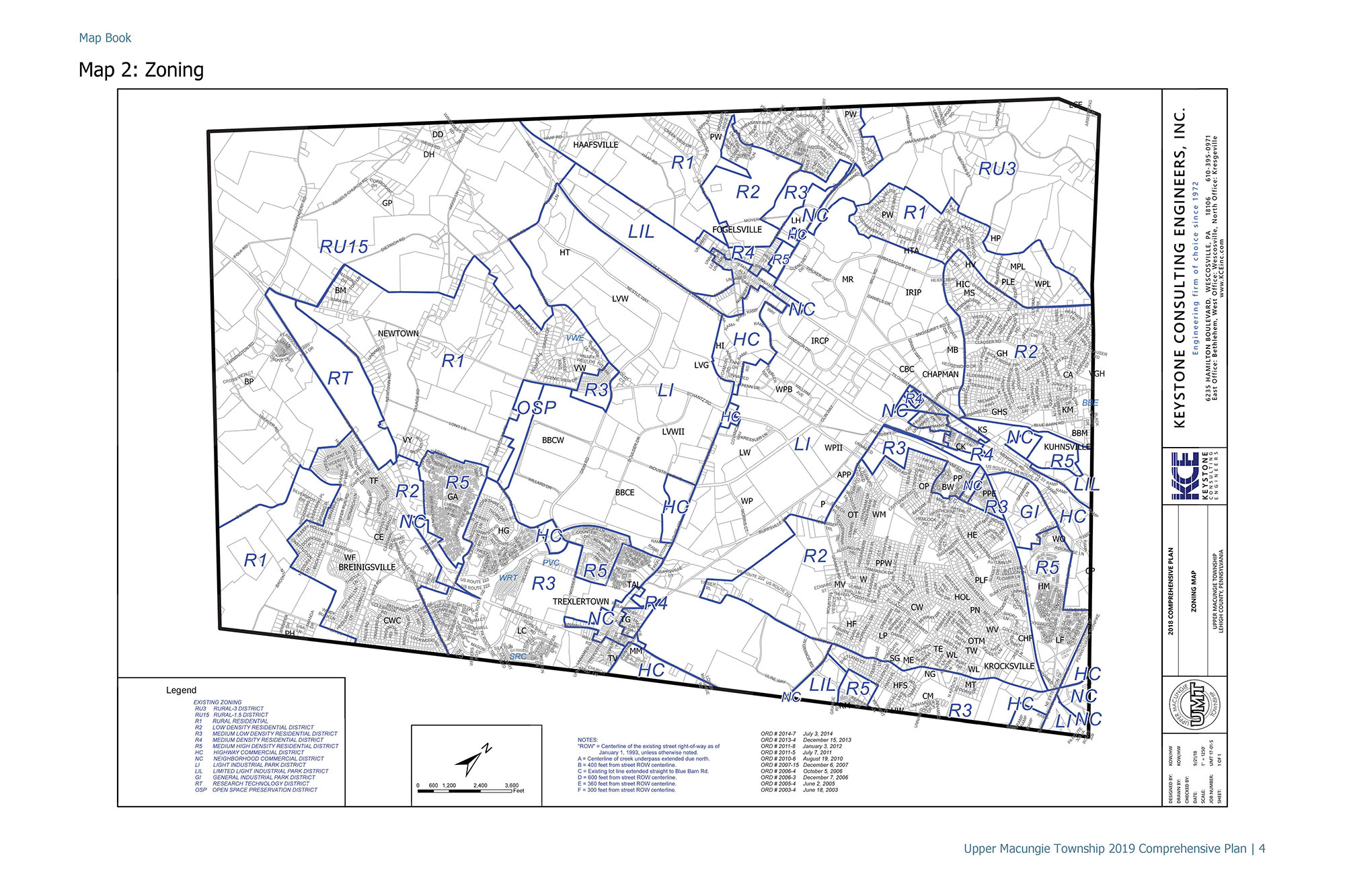
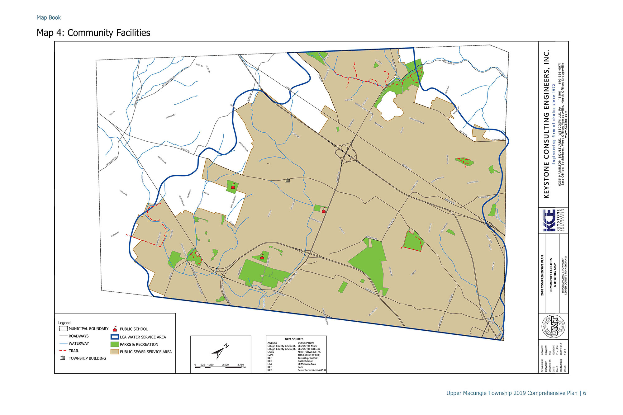
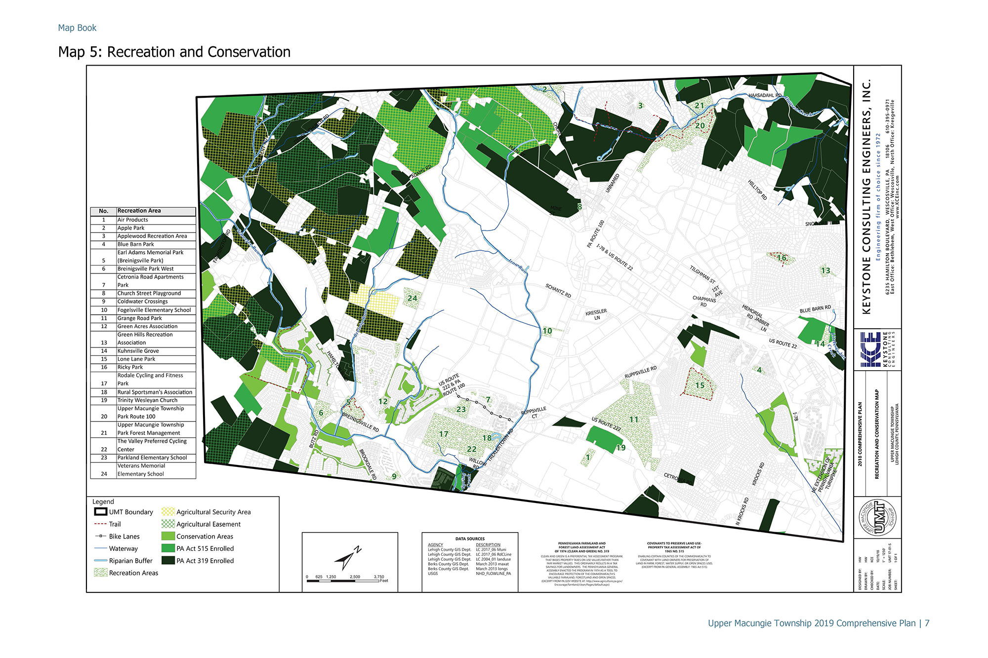
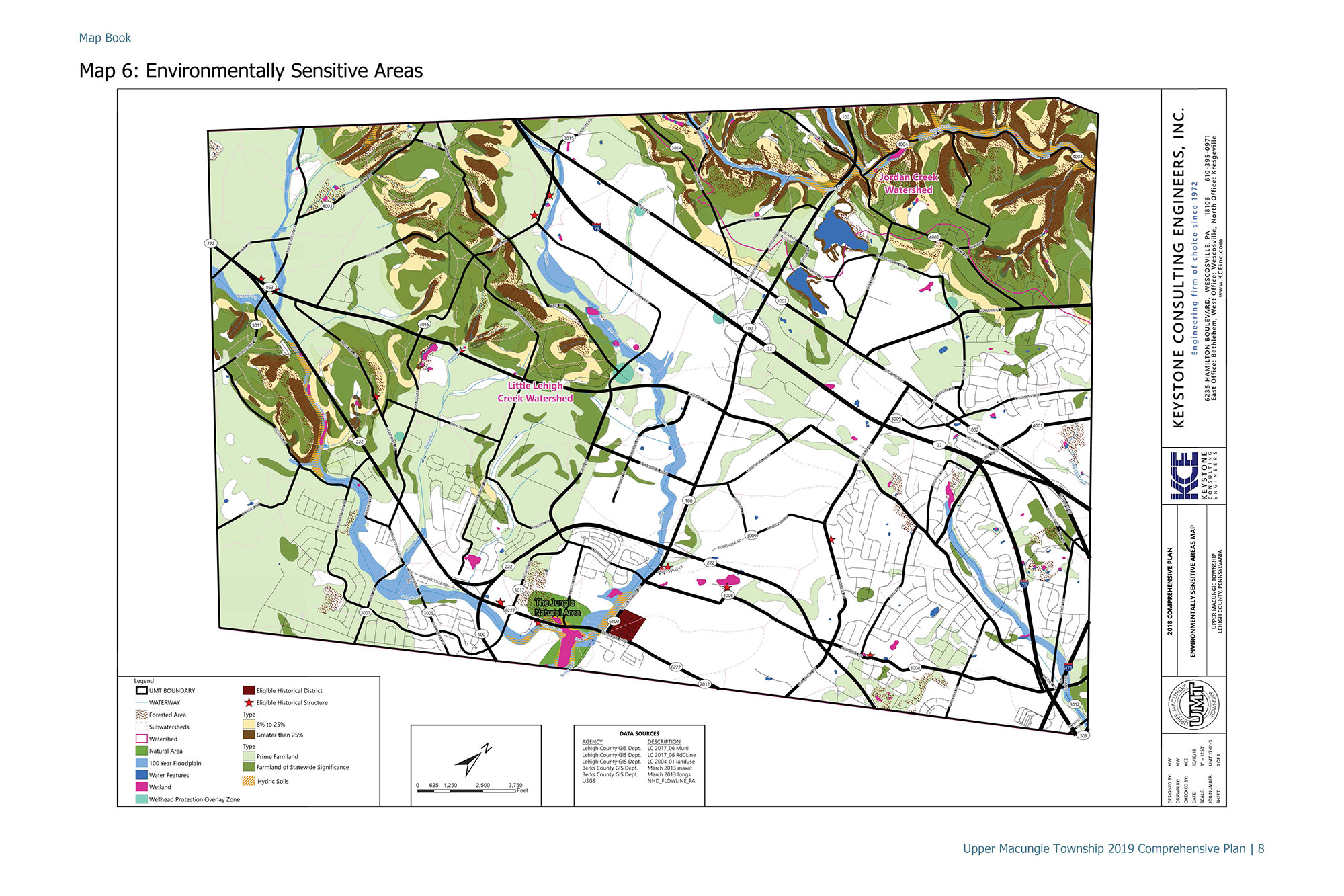
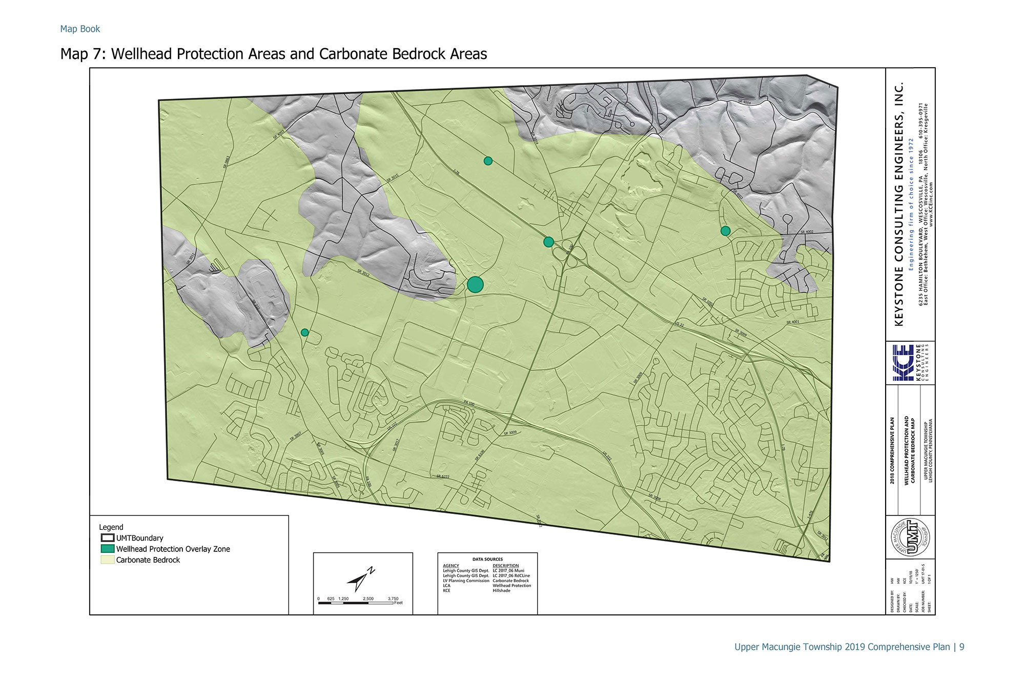
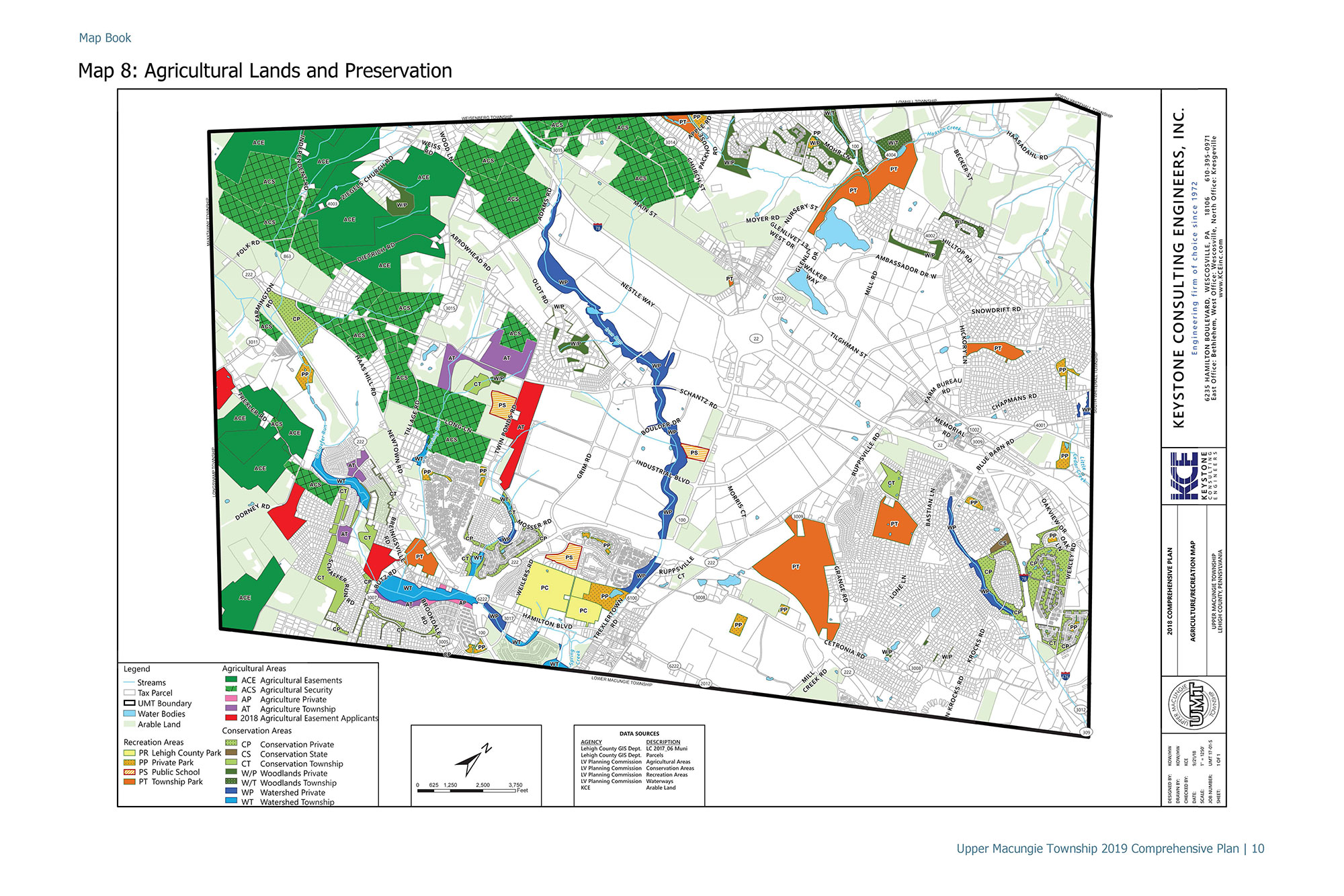
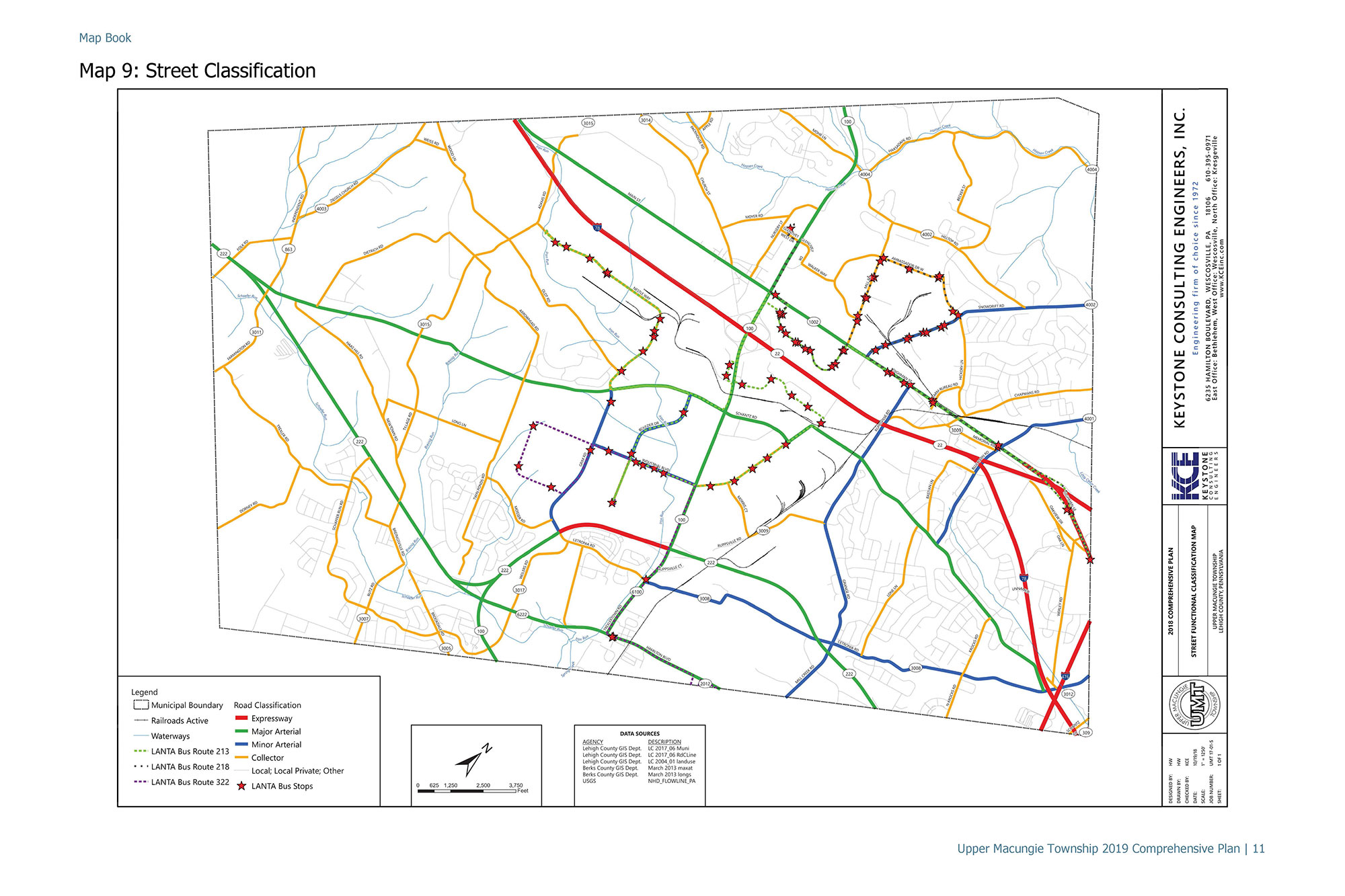
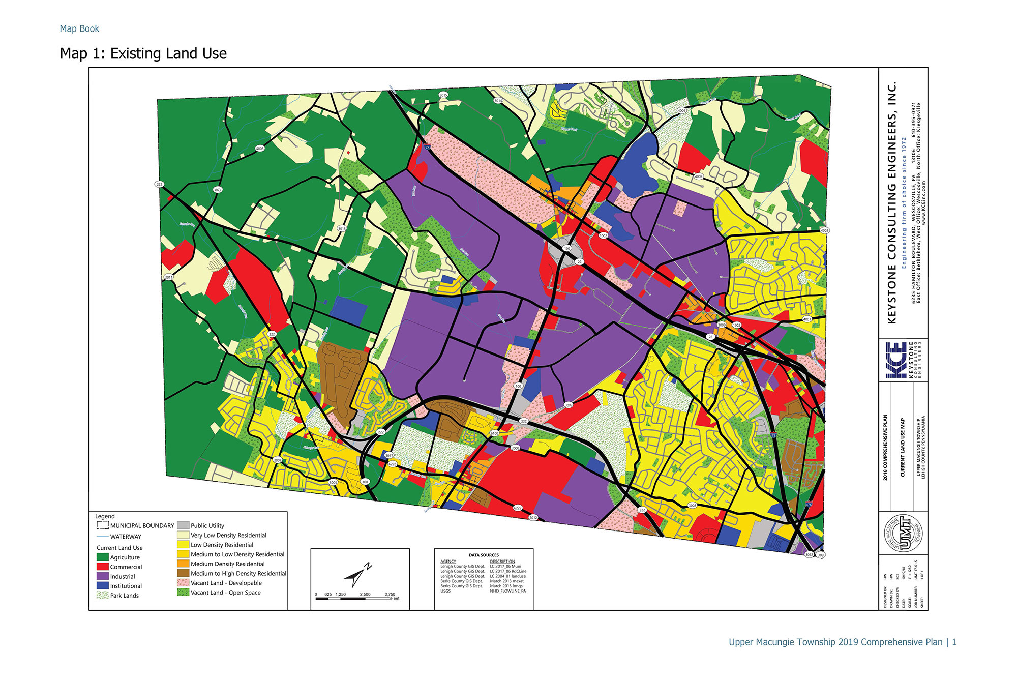
Keystone Consulting Engineers, Inc. (KCE) created the comprehensive plan map for Upper Macungie Township. KCE provided all the mapping and boundaries on the mapping within the comprehensive plan maps. The maps are used by the Township staff, residents, potential developers, etc. to determine zoning boundaries, land use designations, potential karst areas, parks within the municipality, etc.

Location:
Upper Macungie Township, Lehigh County
Tags:

Like this project? Let's share!

Share on Facebook
Share on Twitter
Share on Linkedin
Share by Email

Contact Us

    Your Name (required)

    Your Email (required)

    Subject (required)

    If you know the office you would like to send this to, please select below:

    Your Message